Rock Art Around Las Vegas
Rock art is a precious resource. Please help protect and preserve these sites.
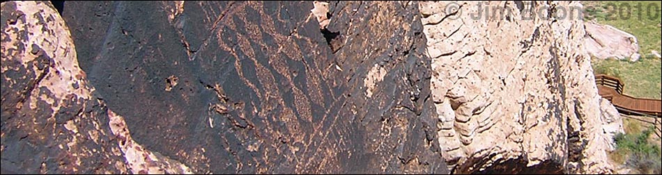
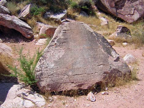
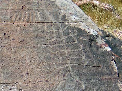
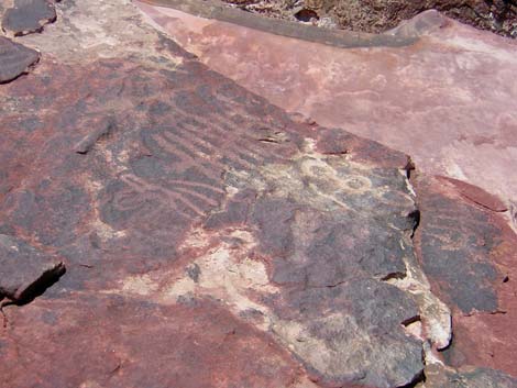
 Blanket panel |
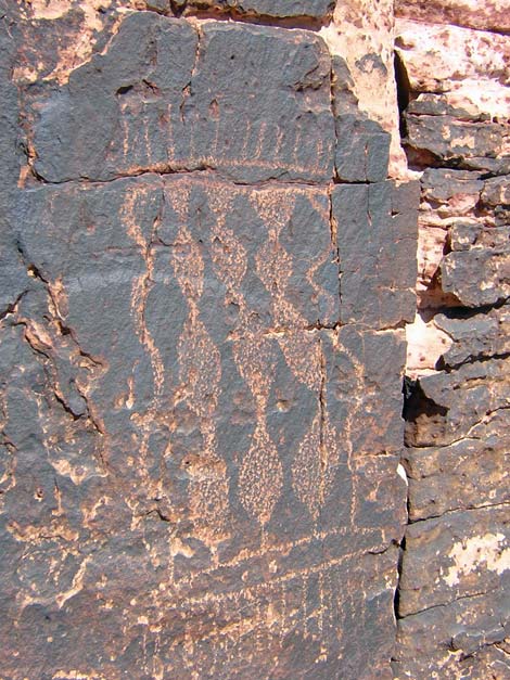
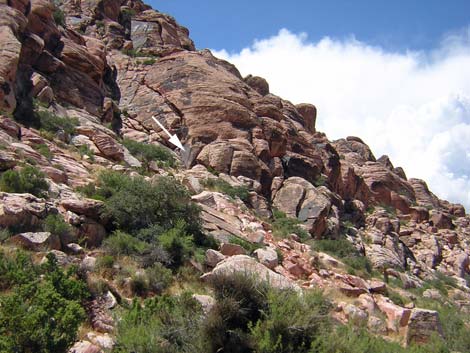
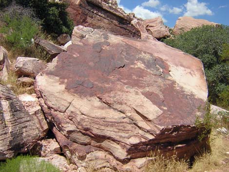
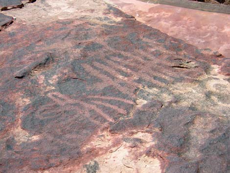
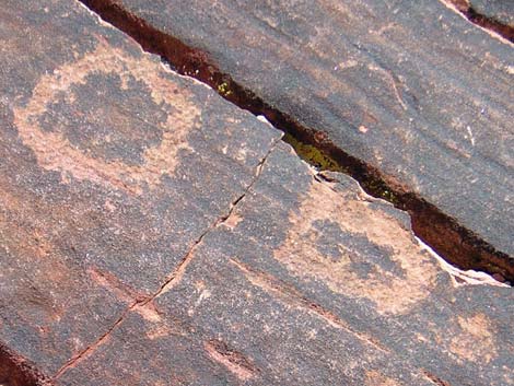
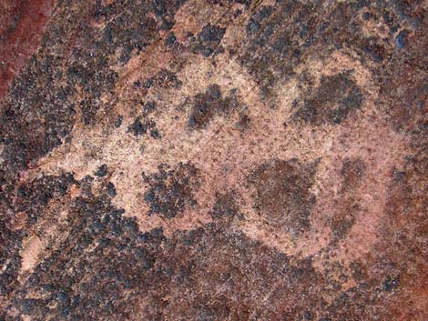
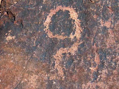
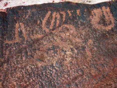
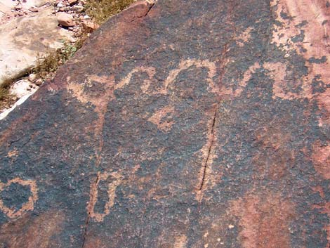
Description Calico Basin is a colorful area tucked between the gray limestone La Madre Mountains to the north, the red sandstone Calico Hills to the west, and a desert ridge to the south. Three springs with permanent water emerge from the base of the red sandstone cliffs: Red Spring, Calico Spring, and Ash Spring. Water also runs in washes to the north and south of the springs during winter. Compared to the surrounding desert, Calico Basin is sheltered and moist, and it is easy to understand why native people spent time here. The outflow from Red Spring feeds a marshy grassland that has recently been protected from trampling by fencing to keep wild burros out and an elevated boardwalk to keep humans off the meadow. Access to Red Spring and most of the petroglyphs is via the boardwalk. There are many large boulders scattered along the base of the sandstone cliffs near Red Spring. Some of the rock faces are covered in desert varnish, a naturally occurring dark patina that forms on the surface of rocks in the desert. Native peoples created most of their petroglyphs by pecking away the thin layer of desert varnish to reveal the underlying red and white sandstone rock. Infrequently however, they just carved images into the surface of unvarnished rocks. Examples of both types of petroglyphs can be seen from the boardwalk (Table 2, Wpt. 1). In addition to the petroglyphs along the boardwalk, there is a nice example of a petroglyph blanket high on the cliffs above Red Springs (Table 2, Wpt. 02). The petroglyph blanket is large (about 4 feet high), but it is best seen with binoculars from the boardwalk near Red Spring. This petroglyph is on a southeast-facing cliff, so from Red Spring, look for it up and to the northwest (see photo). There are petroglyphs on other boulders scattered about the area (Wpt. 03). If visitors scramble around looking for petroglyphs, be careful in the rocks and don't touch or otherwise damage the petroglyphs. |
 Blanket panel (view from boardwalk near Red Spring) |
Native people also made agave-roasting pits in Calico Basin, although none are easily seen in the boardwalk area. To see good examples of agave-roasting pits, drive up the Scenic Loop Road to Willow Springs. Access to Calico Basin is via a good, paved road. Access to the petroglyph area is via a short boardwalk. Location The area is located in Red Rock Canyon National Conservation Area, about 30 minutes west of Las Vegas, but not along the Scenic Loop Road. |
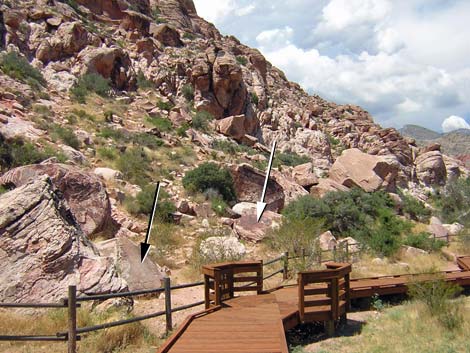 Petroglyphs along boardwalk Black arrow = Boulder 1; white arrow = Boulder 2 |
From town, drive out towards Red Rocks. From Charleston Blvd at Highway 215 (the western beltway) (Table 1, Site 516), drive west on Charleston Blvd for 3.8 miles to Calico Basin Road (Site 520). The turnoff is about 1.5 miles before the entrance to the Scenic Loop. Turn right onto Calico Basin Road and drive north, then west, for about 1 mile to where the paved road makes a 90-degree turn to the right. At this point, turn left, drive through the gate, and enter the Red Springs Picnic Area (Site 464). Red Spring, the actual spring, is located on the far side of the boardwalk loop trail. Hours Red Rocks is a day-use area. The actual opening and closing times generally follow sunrise and sunset. Fees Admission is $5 per day (annual passes accepted), but they don't seem to be collecting fees at Calico Basin these days. |
 Boulder 1 (see photo above) as seen from boardwalk |
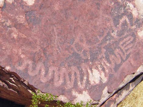
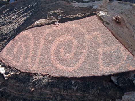
 Boulder #1, close-up of top |
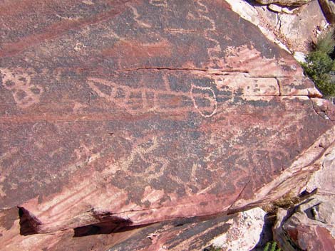
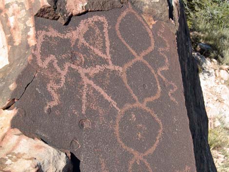
 Boulder #2 |
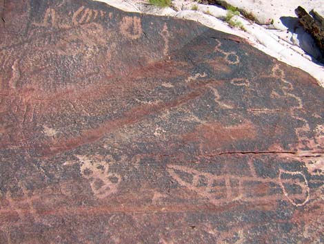
 Boulder #2, close-up of top |
 Boulder #2, close-up of top |
 Boulder #2, close up of bottom |
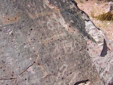
 Boulder southwest of Red Spring |
 Petroglyph on boulder SW of Red Spring |
 Petroglyph on boulders SW of Red Spring |
 Petroglyph on boulders SW of Red Spring |
 Petroglyph on boulders SW of Red Spring |
 Petroglyph on boulders SW of Red Spring |
 Petroglyph on boulders SW of Red Spring |
 Petroglyph on boulders SW of Red Spring |
 |
 |
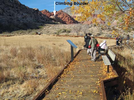 Climbing boulder NW or the boardwalk |
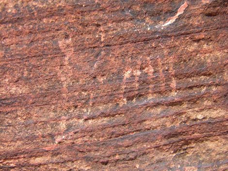 Petroglyph on Climbing Boulder |
Table 1. Highway Coordinates based on GPS data (NAD27; UTM Zone 11S). Download Highway GPS Waypoints (*.gpx) file.
| Site | Location | Latitude (°N) | Longitude (°W) | UTM Easting | UTM Northing | Elevation (feet) | Verified |
|---|---|---|---|---|---|---|---|
| 464 | Red Springs | 36.1447 | 115.4194 | 642204 | 4000954 | 3,670 | Yes |
| 516 | Charleston at the Beltway | 36.1591 | 115.3366 | 649626 | 4002676 | 3,070 | Yes |
| 520 | Charleston Blvd at Calico Basin Road | 36.1418 | 115.3987 | 644071 | 4000667 | 3,506 | Yes |
| Wpt. | Location | Latitude | Longitude | UTM Easting | UTM Northing | Elevation (ft) | Verified |
|---|---|---|---|---|---|---|---|
| 01 | Petroglyphs off Boardwalk | 36.14528 | 115.42001 | 642148 | 4001018 | 3,714 | GPS |
| 02 | Blanket Petroglyph | 36.14473 | 115.42033 | 642120 | 4000956 | 3,797 | GPS |
| 03 | Climbing Rock | 36.14900 | 115.42177 | 641983 | 4001428 | 3,740 | GPS |
Happy Hiking! All distances, elevations, and other facts are approximate.
![]() ; Last updated 240323
; Last updated 240323
| Rock Art | Glossary | Copyright, Conditions, Disclaimer | Home |