Backroads Around Las Vegas
 |
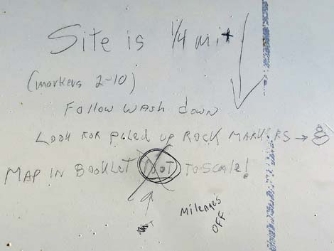
Overview Crystal Wash Main Road provides access to the Crystal Wash Main Archeological Site and Shepherds Camp. The road is a fairly good, 2WD, two-track road that should be suitable for a carefully driven sedan during dry conditions. Rocks in the road are small, but some probably should be moved by people driving sedans. The BLM and Lincoln County opened this area to the public, and Lincoln County printed a brochure with information about the site (including GPS coordinates) as part of their Get Primitive tourism campaign. Download the brochure from Lincoln County or snatch a copy here. Link to map. |
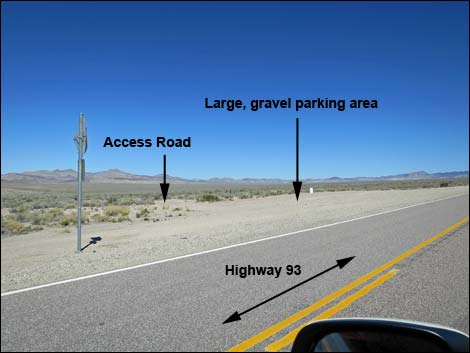 |
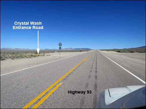
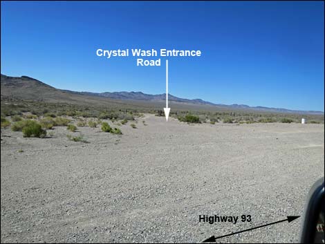
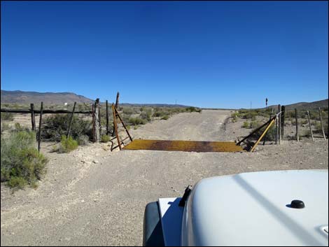
Location Crystal Wash Main Road is located along Highway 93 beyond the Pahranagat Valley, about 110 miles north of Las Vegas. From town, drive north on Interstate 15 to US Highway 93 (Table 1, Site 0674). Exit onto Highway 93 and drive north past Alamo and Ash Springs to the intersection of Highways 93 and 318 (Site 0677). Continue on Highway 93 for 4.06 miles to a large gravel parking area (Site 1099) on the left (north) side of the road. Look for a white trash barrel. Crystal Wash Main Road From the left side of the gravel parking area (Site 1099), the narrow dirt access road runs due north a few tens to yards to the highway fence line and a cattle guard (Site 1100). |
 |
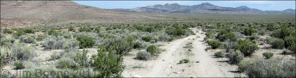
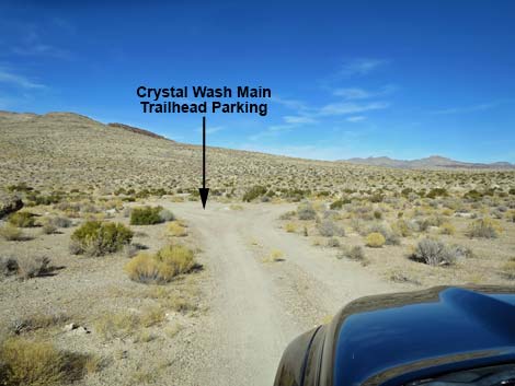
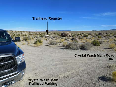
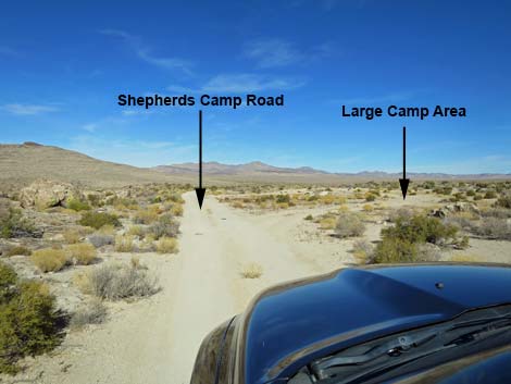
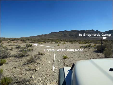
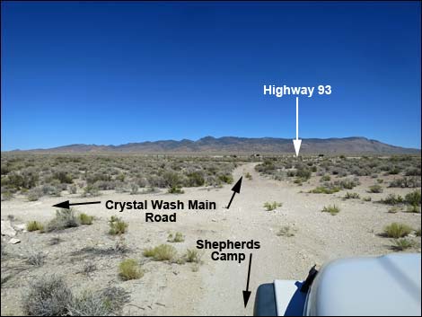
Passing over the cattle guard, the road forks. Crystal Wash Main Road stays left and heads northwest and away from the fence. In about 100 yards, the road arrives at a T-intersection (Site 1101). Crystal Wash Main Road stays right and runs as a two-track road for about 0.6 miles to a parking area (Site 1102), which is just before reaching the broad, sandy wash in the bottom of the valley. The sign-in register is adjacent to the parking area. Park here; this is the Crystal Wash Main Archeological Site trailhead. A spur road to the right runs a few yards into a sandy wash. It is likely that driving down the wash is illegal. Shepherds Road At the T-intersection (Site 1101) 100 yards past the cattle guard, continue straight onto Shepherds Road, a fairly good road, to an old shepherd's long-term campsite that may have been in use from the 1040s to the 1960s. The road continues past the historic camp area to a large, bladed area that is big enough to park 25 RVs. |
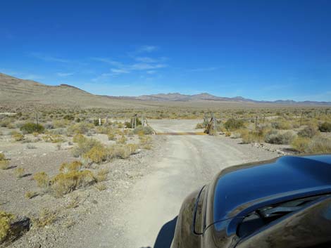 Approaching the fence and cattle guard (view N) |
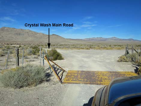 Fenceline and cattle guard (Site 1100; view N) |
 Staying left past the cattle guard |
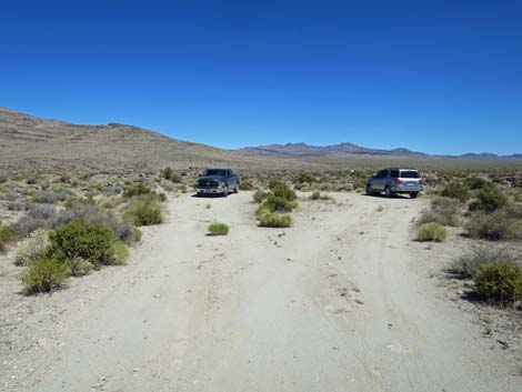
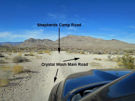 Approaching Shepherds Camp Road intersection (view NW) |
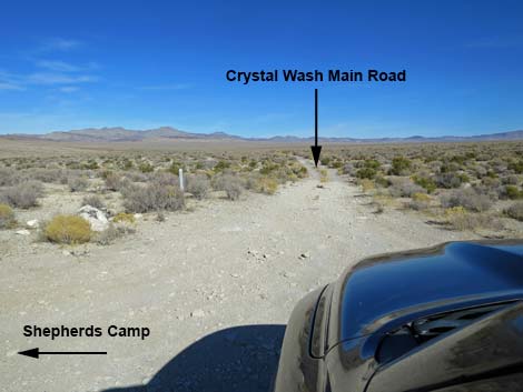 Crystal Wash Main Road (view N from Shepherds Camp intersection) |
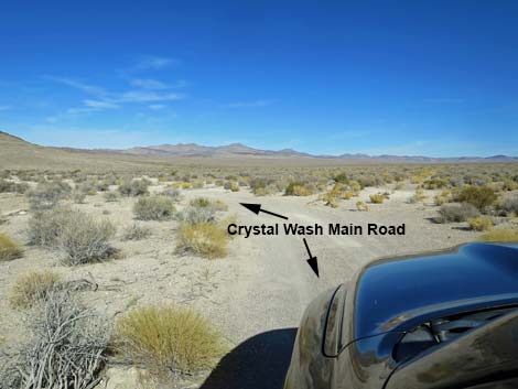 Crystal Wash Main Road stays left at minor side road (view N) |
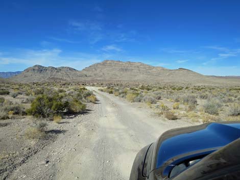
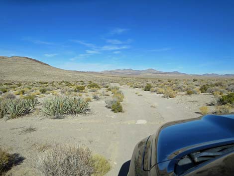
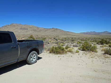
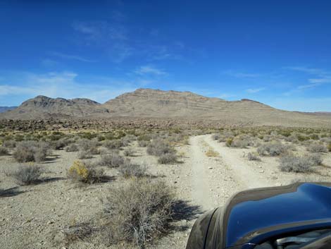 Crystal Wash Main Road (view NW) |
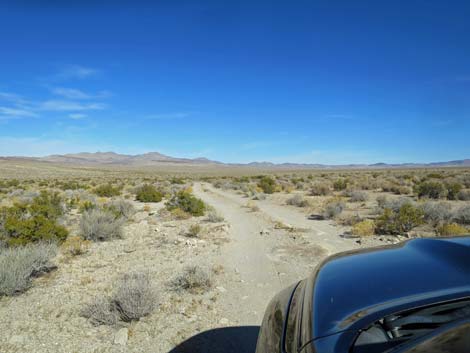 Crystal Wash Main Road with few rocks (view NW) |
 Crystal Wash Main Road with few rocks (view NW) |
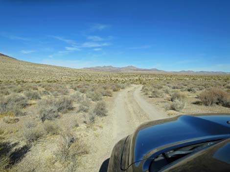 Crystal Wash Main Road (view NW) |
 Approaching Crystal Wash Main Trailhead (view N) |
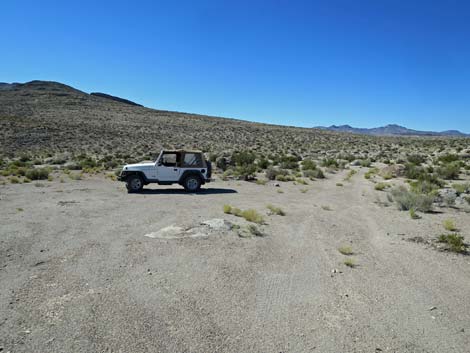
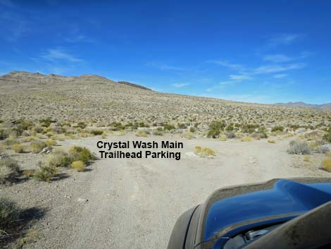 Crystal Wash Main Trailhead (Site 1102; view N) |
 Crystal Wash Main Road continues to the wash (view N) |
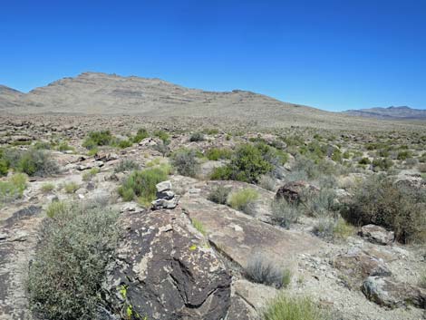
 The first petroglyph site is on boulders beyond the sign (view NE) |
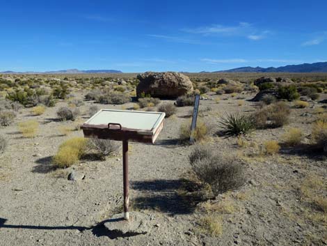 Sign-in register and Site #1 boulder (view NE) |
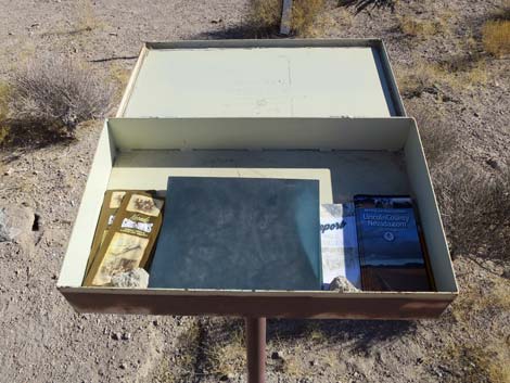 Brochures inside the sign-in register (view NE) |
 Note on the inside lid of the sign-in register (view NE) |
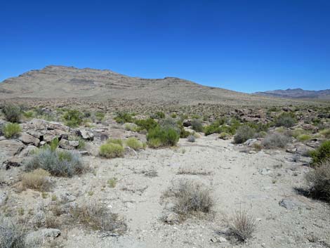
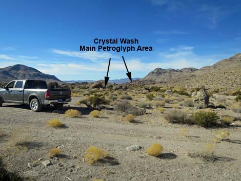 Crystal Wash Main Archeological Sites are down the wash (view SW) |
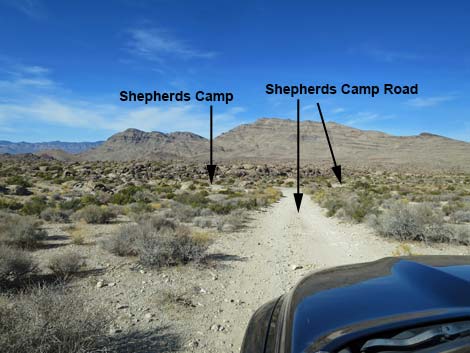
Staying left (straight) onto Shepherds Camp Road
Approaching Shepherds Camp Road intersection (view NW) |
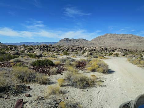
 Shepherds Camp Road approaching Shepherds Camp (view NW) |
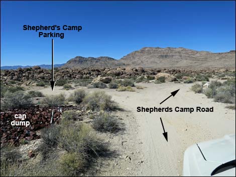
 Shepherds Camp Road at Shepherds Camp can-dump (view NW) |
 Shepherds Camp Road at Shepherds Camp (view NW) |
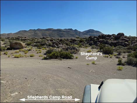 Shepherds Camp (view from Shepherd Camp Parking) |
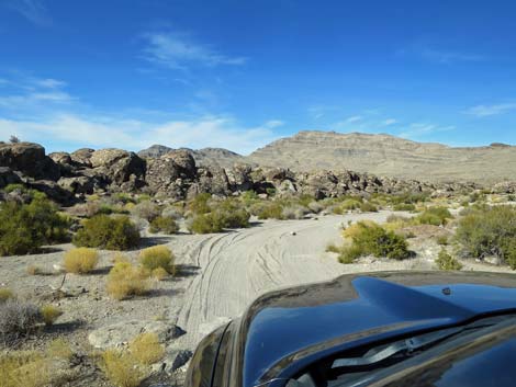 Shepherds Camp Road beyond Shepherd Camp (view NW) |
 Shepherds Camp Road beyond Shepherd Camp (view N) |
 Shepherds Camp Road ends at turn-around (view N) |
 Alternative trailhead for Crystal Wash Main Arch Site (view N) |
 Alternative trail to Crystal Wash Main Arch Site (view NNW) |
 Alternative trail to Crystal Wash Main Arch Site (view NNW) |
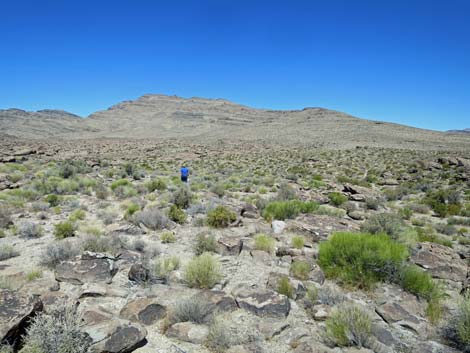 Hiker on alternative trail to Crystal Wash Main Arch Site (view NNW) |
Returning to the Highway
 Crystal Wash Main Road at T-intersection (view SW) |
 Shepherds Road at T-intersection (view SE) |
 Exiting to the cattle guard; highway in background (view S) |
 More to come ... |
Table 1. Highway Coordinates based on GPS data (NAD27; UTM Zone 11S). Download Highway GPS Waypoints (*.gpx) file.
| Site | Location | UTM Easting | UTM Northing | Latitude (N) | Longitude (W) | Elevation (ft) |
|---|---|---|---|---|---|---|
| 1099 | Hwy 93 at Crystal Wash Main Road | 662802 | 4157102 | 37.54839 | 115.15708 | 4,225 |
| 1100 | Crystal Wash Main Cattle Guard | 662791 | 4157152 | 37.54885 | 115.15719 | 4,211 |
| 1101 | Crystal Wash Main at Fork | 662717 | 4157197 | 37.54926 | 115.15802 | 4,204 |
| 1102 | Crystal Wash Main Trailhead Parking | 662487 | 4158033 | 37.55684 | 115.16044 | 4,137 |
| 1103 | Shepherds Camp | 662645 | 4157238 | 37.54965 | 115.15882 | 4,198 |
| 1104 | Shepherds Camp Road End | 662560 | 4157488 | 37.55191 | 115.15974 | 4,181 |
Happy Hiking! All distances, elevations, and other facts are approximate.
![]() ; Last updated 240323
; Last updated 240323
| Backroads | Rock Art | Glossary | Copyright, Conditions, Disclaimer | Home |