 |
| Home | Petroglyphs | Keyhole Canyon Road |
|
Keyhole Canyon Road Map |
|
Rock art is a precious resource. Please help protect and preserve these sites. |
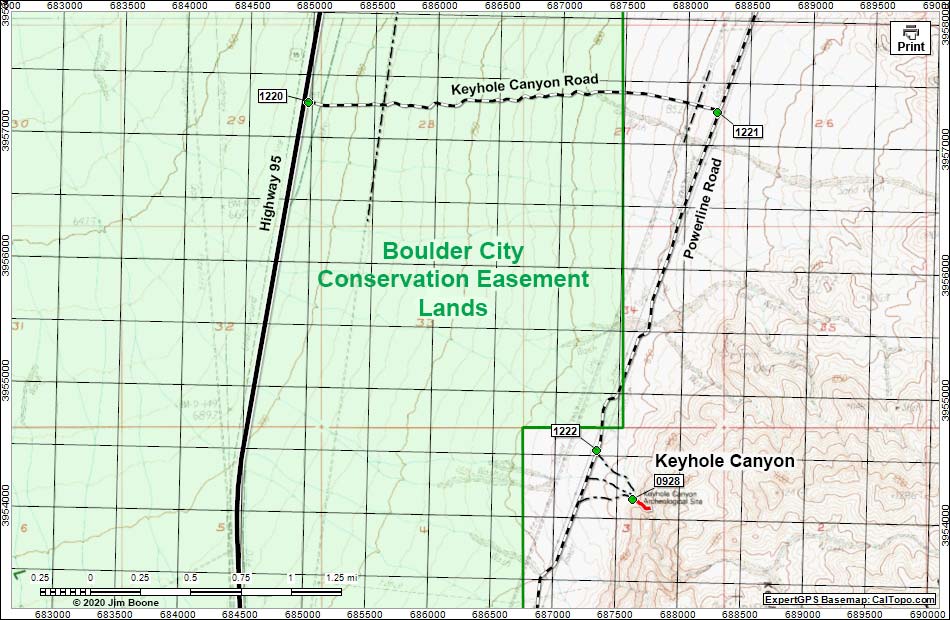 |
| Note: Map based on USGS 7.5 minute topo map, which may have red grid lines and various numbers. North is at the top. Grid is UTM NAD27 CONUS. Roads are black (solid = paved; dashed = unpaved; width implies quality). Trails and routes are red (solid = main; dashed = adjacent or alternate). BLM areas (no color overlay) based on BLM data. Download waypoint coordinates from route description page. Click inside blue rectangles to enlarge those sections of the map. |
Happy hiking! All distances, elevations, and other facts are approximate.
 ; Last updated 200120 ; Last updated 200120 |
|