Birding Around Las Vegas, Outside the Las Vegas Valley
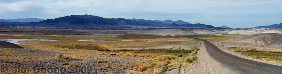
 Shallow Lake; Tecopa Hot Springs is in the background (view SE) |
Description Tecopa Marsh is a spot of water and green amid an astoundingly arid piece of desert. This isn't a birding destination, rather it is a place to stop along the highway, relax for a few minutes, and spot a few birds and ducks before driving on to somewhere else. I usually stop here for a few minutes on the way to and from Death Valley. Tecopa Marsh occupies the east edge of a broad, dry lakebed (playa) on the edge of a broad, flat, sparsely vegetated valley. The marsh sits up against mud hills and a rocky hill. Atop the hill is the town of Tecopa Hot Springs. |
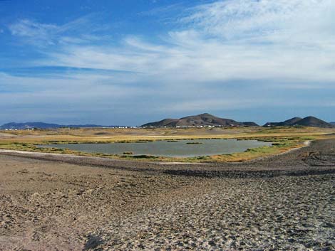
 Shallow lake north of Tecopa Hot Springs (view S) |
An historic railroad ran across the playa, and the railroad bed acts as a dike holding back water to form ponds and marshes. The vegetation is dominated by bulrushes, needle rush, pickleweed, saltgrass, and a few saltbushes. The soils are salty, so little grows here except salt-tolerant species. During dry years, the only open water is north of Tecopa Hot Springs town, but during wet years, open water also occurs west and south of town. There are no particular hot spots, but any water in the desert is a hot spot. Because of the mud, birding from the road usually is the only practical option. The entire marshy area is administered by the U.S. Bureau of Land Management as the Grimshaw Lake Natural Area. Grimshaw Lake, proper, is located south of Tecopa Hot Springs, west of the highway, but it is dry during most years. |
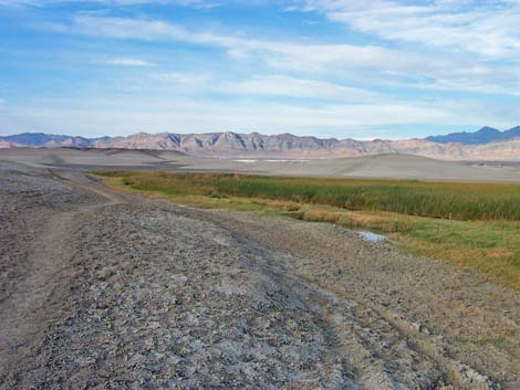 Marsh with hot springs and swimming holes (view N) |
Location The Tecopa marsh is located about 1.5 hours northwest of Las Vegas. The easiest way to get there from Las Vegas is to drive north on Highway 95 for about 90 miles to Highway 373 at Amargosa Valley (Table 1, Site 689). Turn left onto Highway 373 and drive south. At the California-Nevada state line, the road changes to Highway 127. Continue south on Highway 127 past the towns of Death Valley Junction and Shoshone. Just south of Shoshone, turn left (Site 704) and drive southeast towards Tecopa Hot Springs. Before getting to Tecopa Hot Springs, you will see the large, shallow lake (Site 705) is on the right (south) side of the road. |
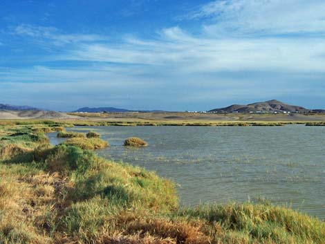
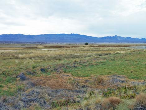 This grassy area (Grimshaw Lake) is located between Tecopa and Tecopa Hot Springs (view NW) |
If you continue south on the road past Tecopa Hot Springs and down the hill on the other side, you will see another grassy area to the west of the road before getting to the town of Tecopa (Site 709). This is Grimshaw Lake, proper (Site 707). A short dirt road leads to a parking lot near the grassy area; you can also park by the pavement and walk about 1 minute to the parking lot. An alternate route is to drive out of the Las Vegas valley on Highway 160 towards Pahrump. Before getting to Pahrump, turn left onto the Old Spanish Trail Highway (Site 708). Drive southwest, across the desert, over the mountains, and down into Tecopa. In "downtown" Tecopa (Site 709), turn right at the triangle-intersection and drive north on the paved road to Tecopa Hot Springs. |
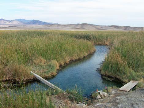 Free swimming hole |
Hours Always open, but this area should be considered day-use only. Fees None. |
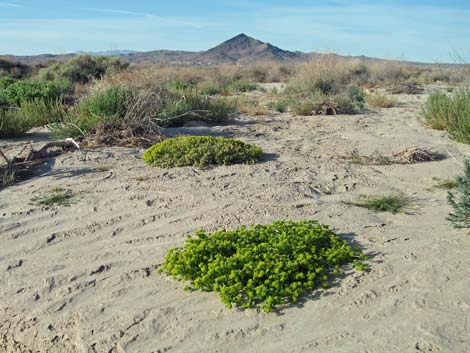 Odd plants grow out here |
Specialties This is an area to look for migrants such as ducks, geese, and wading birds. Like so many other birding places in the desert, this isn't a destination, but rather a neat place to stop and visit on your way to somewhere else. You never know what you will find here because there are few resident species (unless you count the House Sparrows around the County Park). Keep an eye out for such species as Common Raven, Say's Phoebe, Snow Goose, Loggerhead Shrike, Phainopepla, House Finch, Brewer's Blackbird, Red-winged Blackbird, Savannah Sparrow, Green-winged Teal, Ruddy Duck, Killdeer, American Pipit, and Western Meadowlark. Be sure to stop at the County Park in Tecopa Hot Springs to take a dip in the hot springs. Unfortunately, the bathhouse is divided into separate sides for men and women. There is a nice little undeveloped hot pool just north of the road across from the lake north of town (Site 710). |
Table 1. GPS Coordinates for Highway Locations (NAD27; UTM Zone 11S). Download Highway GPS Waypoints (*.gpx) file.
| Site # | Location | Latitude (°N) | Longitude (°W) | UTM Easting | UTM Northing | Elevation (feet) | Verified |
|---|---|---|---|---|---|---|---|
| 689 | Highway 95 at Highway 373 | 36.6439 | 116.3995 | 553676 | 4055332 | 2,660 | Yes |
| 704 | Highway 127 at Shoshone turnoff north | 35.8994 | 116.2578 | 566981 | 3972848 | 1,362 | Yes |
| 705 | Lake on north side of Tecopa Hot Springs | 35.8845 | 116.2353 | 569019 | 3971207 | 1,329 | Yes |
| 707 | Tecopa Hot Springs, Grimshaw Lake | 35.8560 | 116.2320 | 569346 | 3968049 | 1,329 | Yes |
| 708 | Highway 160 at Old Spanish Trail Highway | 36.0730 | 115.7673 | 611006 | 3992542 | 1,025 | Yes |
| 709 | Tecopa town | 35.8487 | 116.2264 | 569860 | 3967439 | 1,329 | Yes |
| 710 | Tecopa Hot Springs (hot spring north of town) | 35.8860 | 116.2342 | 569121 | 3971577 | 1,335 | Yes |
Happy birding! All distances, elevations, and other facts are approximate.
![]() ; Last updated 240323
; Last updated 240323
| Birding Around Las Vegas | Southern Nevada Birds | Guide Service | Copyright, Conditions, Disclaimer | Home |