Birding Around Las Vegas, Mount Charleston Area, Kyle Canyon

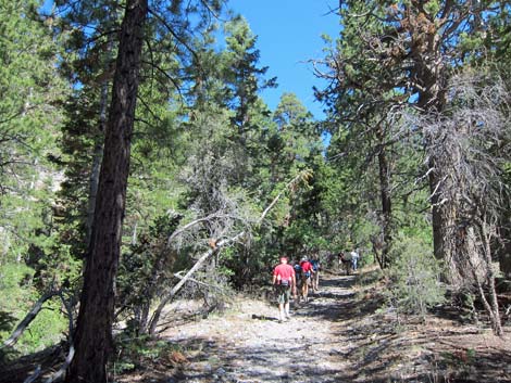 Trail in Pine-Fir Woodland |
Overview The Stanley B Springs Trail runs about 1.0 miles up an old road on the north side of Kyle Canyon (forested, south-facing slopes) to an area of springs surrounded by ponderosa pine, white fir, mountain mahogany, and limestone cliffs. The main wet area, the confluence of two smaller canyons, is a good place to relax in the shade and watch birds as they come in for water. Just above the confluence in the east fork, a use-trail leads to two mines that provide habitat for forest bats (grates keep humans out), and water trickles from the lower mine for birds and other wildlife. Link to trail map.For details of the hike, see the Stanley B Springs Trail hiking webpage. |
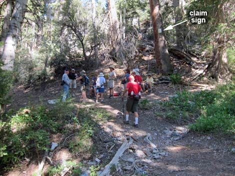 Birders at the confluence |
Watch Out Other than the standard warnings about hiking in the desert, ... this trail is relatively safe. Some parts of the hike are pretty steep for an old road, so take it easy at this elevation if you've just come up from the desert. Two mines are blocked with heavy grates, but be careful if exploring off trail. Stay out of the stinging nettles. While hiking, please respect the land and the other people out there, and try to Leave No Trace of your passage. Also, even though this is a short hike, be sure to bring what you need of the 10 Essentials. This hike goes into the Mount Charleston Wilderness Area, so pay particular attention to respecting the land. |
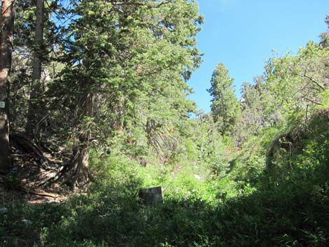 Moist habitat with running water at the confluence |
Getting to the Trailhead This hike is located in Kyle Canyon up in the Spring Mountains National Recreation Area, about 45 minutes northwest of Las Vegas. From town, drive out Highway 95 to Kyle Canyon Road, then turn left and continue up Kyle Canyon Road. From the intersection with Deer Creek Road (Highway 158), continue up Kyle Canyon for 1.7 miles to a wide, paved parking area on the right. Park here; this is the trailhead. |
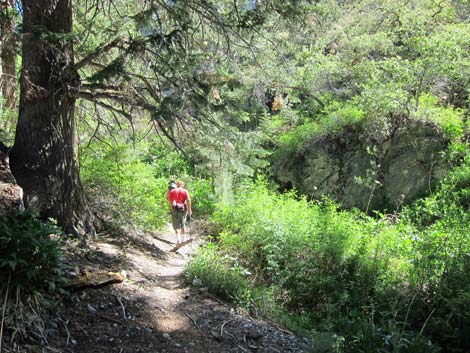 A birder starts up the east fork (view NE from the confluence) A birder starts up the east fork (view NE from the confluence) |
The Hike From the trailhead parking area (Table 1, Waypoint 01), the trail starts another 400-ft up the road. The highway shoulder is narrow, and some drivers exceed the speed limit, so walk quickly and carefully to the old dirt road (Wpt. 02) that cuts up and right (east) across the steep hillside above the road. On the old dirt road, the trail passes a gate and continues up across the hillside. This area has been heavily thinned to reduce the danger of wildfires, but the remaining ponderosa pine, manzanita, and shrubby gambel oak provide open habitat for woodland birds. Watch for Empidonax flycatchers and Black-headed Grosbeak along here. |
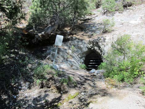 Grated mine and trickle of water in east fork (view W) |
Eventually the trail turns more to the north and starts up Stanley B Canyon. In this area, the trail exits the thinning zone and tall mountain mahogany and gambel oak form a nearly impenetrable thicket in this Pinyon-Juniper Woodland. This provides shade for hikers, but birders will need to listen more carefully because the birds (e.g., Juniper Titmouse and Plumbeous Vireo) will be harder to see. The trail winds about the hillside generally running northwest and eventually drops closer to the bottom of the canyon where more-moist conditions support tall ponderosa pine and white fir, a species typical of higher elevations. In this more-moist Pine-Fir Woodland, watch and listen for birds such as Mountain Chickadee, Brown Creeper, Cassin's Finch, and Western Tanager. |
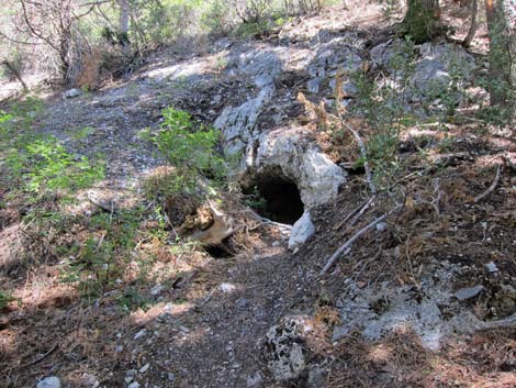 Shallow mine in west fork (view N) |
Farther up, the trail drops into the bottom of the canyon, soil conditions become even more moist, and wild rose, Rocky Mountain maple, blue elderberry, angelica, and stinging nettle become common, as do Broad-tailed Hummingbirds. Shortly, water trickles in the creek and the trail arrives at the confluence of two canyons (Wpt. 05) in a shady, moist area with lots of forbs and birds. This is a good place to relax in the shade and listen to the birds. Birders can continue up the east canyon to two mines (Wpt. 06, 07), the lower of which trickles water, or up the west canyon (Wpt. 08) to the official Stanley B Springs. Return to the trailhead by following your footprints back down the trail to the trailhead. |
Table 1. Hiking Coordinates Based on GPS Data (NAD27; UTM Zone 11S). Download Hiking Waypoints (*.gpx) file.
| Wpt. | Location | UTM Easting | UTM Northing | Elevation (ft) | Point-to-Point Distance (mi) | Cumulative Distance (mi) | Verified |
|---|---|---|---|---|---|---|---|
| 01 | Trailhead | 622805 | 4013426 | 7,019 | 0.00 | 0.00 | GPS |
| 02 | Leave Pavement | 622683 | 4013411 | 7,067 | 0.08 | 0.08 | GPS |
| 03 | Camp Area | 622864 | 4013969 | 7,519 | 0.65 | 0.73 | GPS |
| 04 | Use-trail Junction | 622783 | 4014069 | 7,540 | 0.08 | 0.81 | GPS |
| 05 | Confluence | 622554 | 4014558 | 7,792 | 0.36 | 1.17 | GPS |
| . | . | . | . | . | . | . | . |
| 06 | Wet Grated Mine | 622527 | 4014645 | 7,885 | 0.07 | 0.07 | GPS |
| 07 | Dry Grated Mine | 622506 | 4014689 | 7,947 | 0.04 | 0.11 | GPS |
| . | . | . | . | . | . | . | . |
| 08 | Campsite | 622423 | 4014577 | 7,944 | 0.10 | 0.10 | GPS |
Note: All distances, elevations, and other facts are approximate.
![]() ; Last updated 240322
; Last updated 240322
| Birding Around Mt Charleston | Birding Around Las Vegas | Glossary | Copyright, Conditions, Disclaimer | Home |