Birding Around Las Vegas, Mount Charleston Area, Kyle Canyon
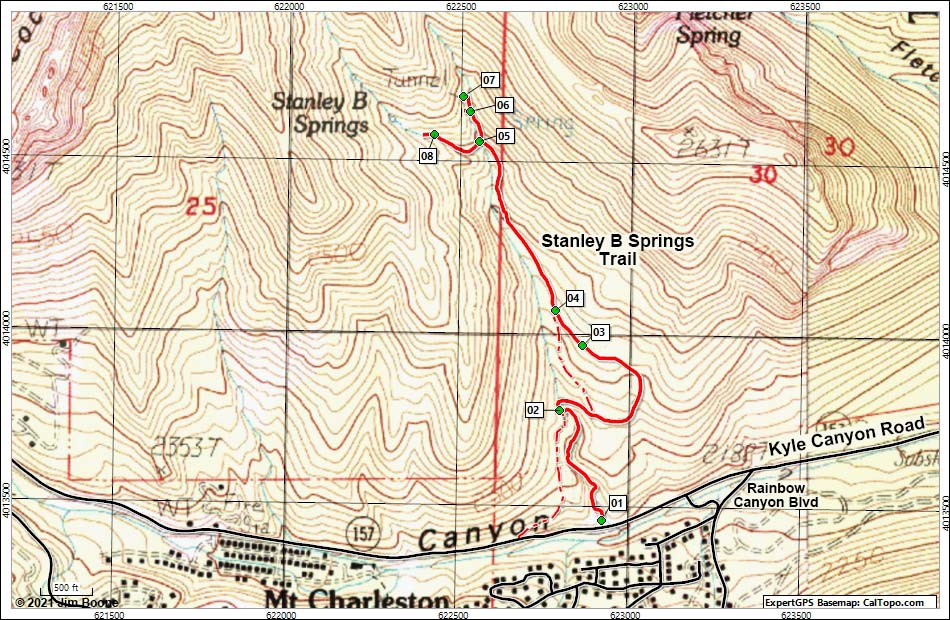
Note: Roads are black (solid = paved; dashed = unpaved). Trails and routes are red (solid = main; dashed = adjacent or alternate). Map based on USGS 7.5 minute topo map. North is at the top. UTM Grid is NAD27 CONUS.
Happy birding! All distances, elevations, and other facts are approximate.
![]() ; Last updated 120625
; Last updated 120625
| Stanley B Springs | Birding Around Mt. Charleston | Glossary | Copyright, Conditions, Disclaimer | Home |