Birding Around Las Vegas, Mount Charleston Area
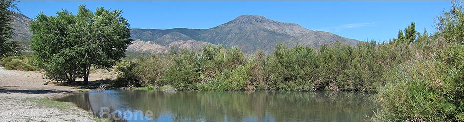
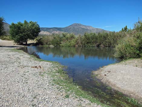
 First small pond below Cold Creek Town |
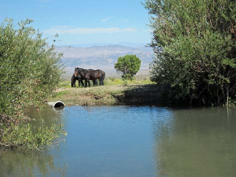
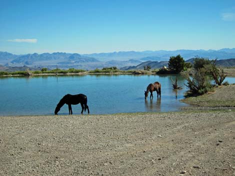
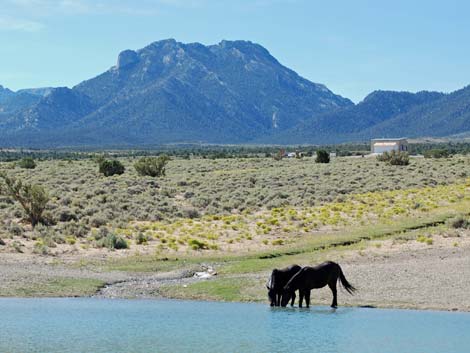
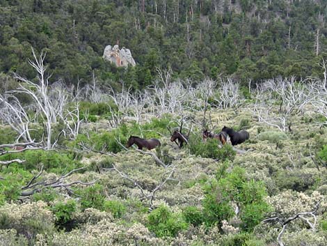
Description Cold Creek provides birders an interesting mix of desert and mountain habitats. There are no real birding hotspots, but water concentrates the birds in a few places. Cold Creek is located high on the northeastern flank of the Spring Mountains at the interface of three habitat types: Mojave Desert Scrub, mountain forest at the transition between the Yellow Pine and Pine-Fir life zones, and an old burn area grown up in brush, all with a bit of water thrown in. There are two main areas to bird: a cluster of three ponds connected by streams in the desert scrub just downhill from Cold Creek Town, and a spring area at the edge of the forest (at the end of a dirt road usually requiring a high-clearance vehicle). Be sure to look for elk, and wild horses, and dragonflies here too. |
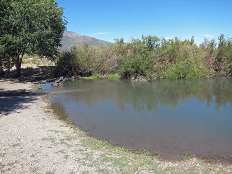
 Second small pond below Cold Creek Town |
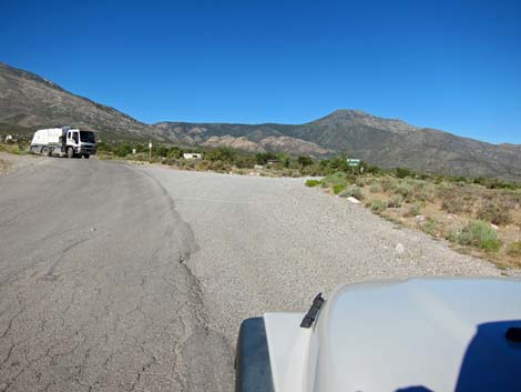
Location Cold Creek is located northwest of Las Vegas, high on the northeastern flanks of the Spring Mountains. From downtown Las Vegas, drive north on Highway 95 (past the two turn-offs to Mt. Charleston) to Cold Creek Road (about 5 miles past Hwy 156). Watch for signs to the State Correctional Center. Turn left at the prison (Table 1, Site 0341) onto Cold Creek Road and drive northwest and up the hill for about 15 miles to the town of Cold Creek (Site 0671). There are two main places to bird: the ponds just before town, and a spring in the woods at the Bonanza Peak Trailhead. To find the ponds, drive up Cold Creek Road for about 13.1 miles to Willow Creek -- Wheeler Pass Road, which forks to the right about 1/2-miles before town. Wheeler Pass Road is a well-used, graded dirt road, marked with a numbered road marker (Forest Road 601) and perhaps a "no shooting" sign. |
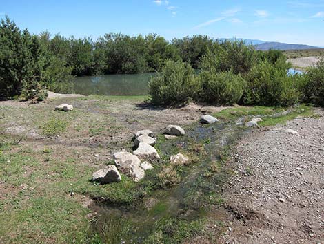
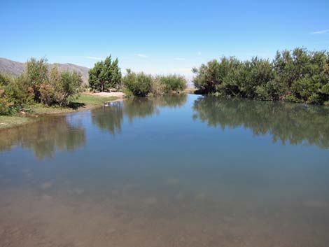
 Third pond below Cold Creek Town |
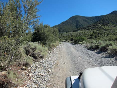
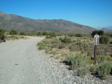
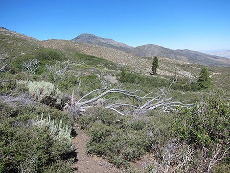
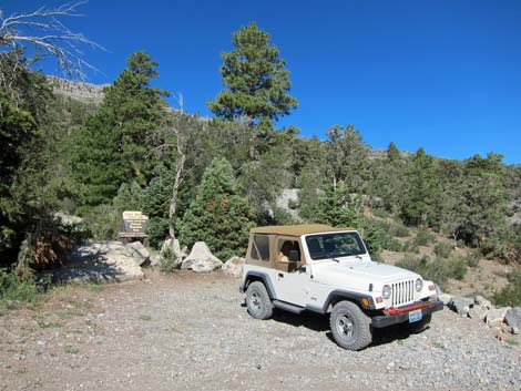
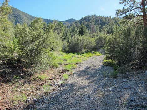
Turn right onto Wheeler Pass Road and drive northwest. The first two ponds (Site 0454) are within sight (about 100 yards) of the pavement, and the third pond (Site 0672) is down a dirt side-road about 0.4 miles due north of the first two ponds. Located in high-elevation Mojave Desert Scrub habitat, these ponds are the only water and willow thickets around, so they attract plenty of resident desert birds and migrants. To find the spring area at the edge of the forest, continue up Cold Creek Road to the Bonanza Peak Trailhead. Stay on the paved Cold Creek Road, bearing left (southwest) through town. The pavement ends at the far edge of town, but the road generally is graded the remaining 2 miles to the trailhead (Site 0259). Snow on the road is not plowed during winter, and the exact road conditions depend on when it was last graded. Follow the dirt road as it runs into the shrubby old burn area. The forest is growing back slowly, but it is mostly bushy thickets at this point. Watch for birds, elk, and wild horses in this area. |
 Cold Creek Road in old burn area (view SW) |
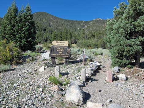
The road ends at Bonanza Peak Trailhead, a large parking area with signs for Camp Bonanza and the Bonanza Trail. The trailhead is located near a spring and "meadow" at the edge of a mixed forest of ponderosa pine and white fir, so there is water and a good mix of habitats for watching birds. From the trailhead, birders can walk up the Bonanza Peak Trail into the high mountain woods, but the better birding is around the parking area and along the closed road that leads to Bonanza Camp, which follows the stream. There are actually a number of springs and streams in this area, so the birds are not as concentrated as they are in other riparian areas. Hours Always open Fees None. |
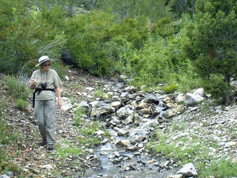 Creek near Bonanza Camp |
Specialties The ponds below town are good for desert species and migrants. Watch the sky for soaring birds (Red-tailed Hawk, Golden Eagle, White-throated Swift, Barn Swallows), and watch the ponds for sparrows (e.g., Black-throated Sparrow, Chipping Sparrow), House Finch, shorebirds (Spotted Sandpiper), and warblers (Yellow Warbler, Yellow-rumped Warbler, and Orange-crowned Warbler). I have never seen any ducks here, but this can be good for dragonflies and wild horses. In the shrubby burn area, keep an eye out for Western Bluebirds, Green-tailed Towhee, Spotted Towhee, and elk. The end of the road is a good place to find woodpeckers (including Lewis' Woodpecker), Mountain Chickadee, White-breasted Nuthatch, Brown Creeper, Yellow-rumped Warbler, Spotted Towhee, Cassin's Finch, Sharp-shinned Hawk, and Woodhouse's Scrub-Jay. |
 Cold Creek Road at Wheeler Pass Road (Forest Rd 601; view W) |
 Wheeler Pass Road: road number 601 (view NW) |
 First pond |
 First pond |
Second pond |
 Second pond |
 Third pond |
 Third pond |
 Shrubby burn area |
 Shrubby burn area |
 Parked by Camp Bonanza sign |
 Bonanza Trail area |
 Bonanza Camp area |
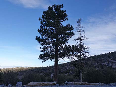 Ponderosa Pine at sunset |
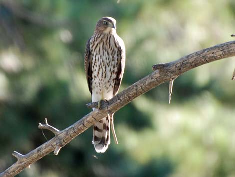 Hopeful Sharp-shin Hawk watching over the stream |
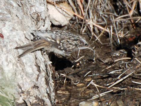 Brown Creeper coming in for a bath |
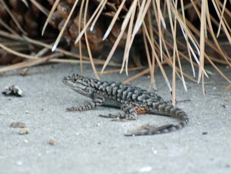 Western Fence Lizard (Sceloporus occidentalis) |
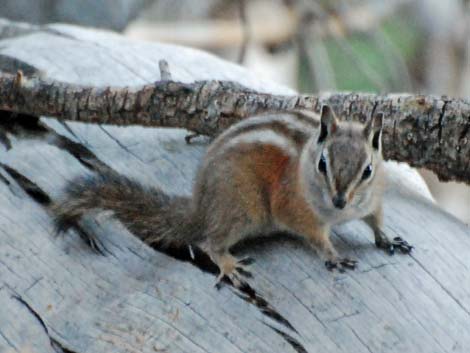 Charleston Mountain Chipmunk (Neotamias palmeri) |
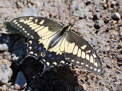 Western Tiger Swallowtail (Papilio rutulus) |
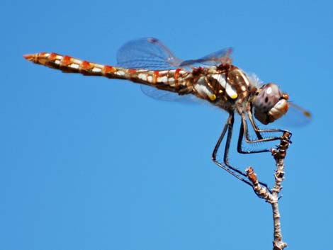 Variegated Meadowhawk (Sympetrum corruptum) |
Table 1. GPS Coordinates for Highway Locations (NAD27; UTM Zone 11S). Download Highway GPS Waypoints (*.gpx) file.
| Site # | Location | Latitude (°N) | Longitude (°W) | UTM Easting | UTM Northing | Elevation (feet) | Verified |
|---|---|---|---|---|---|---|---|
| 259 | Bonanza Peak Trailhead | 36.3821 | 115.7399 | 613021 | 4026870 | 7,513 | Yes |
| 341 | Highway 95 at Cold Creek Road | 36.5237 | 115.5473 | 630061 | 4042819 | 2,970 | Yes |
| 454 | Cold Creek Ponds | 36.4225 | 115.7308 | 613779 | 4031353 | 6,030 | Yes |
| 671 | Cold Creek town | 36.4157 | 115.7365 | 613277 | 4030600 | 6,197 | Yes |
| 672 | Cold Creek Ponds (3rd pond) | 36.4277 | 115.7313 | 613779 | 4031353 | 5,873 | Yes |
Happy birding! All distances, elevations, and other facts are approximate.
![]() ; Last updated 240322
; Last updated 240322
| Birding Around Las Vegas | Southern Nevada Birds | Guide Service | Copyright, Conditions, Disclaimer | Home |