Birding Around Las Vegas, Lake Mead Area
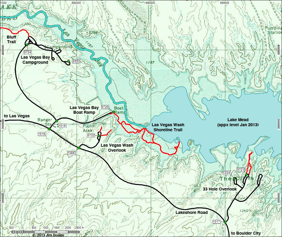
Note: Roads are black (solid = paved; dashed = unpaved). Trails and routes are red (solid = main; dashed = adjacent or alternate). Map based on USGS 7.5 minute topo map. North is at the top. Grid is UTM NAD27 CONUS. National Park Areas (boundaries dashed green, fill light green) based on NPS data. Water is blue.
Table 1. GPS Coordinates for Highway Locations (NAD27; UTM Zone 11S). Download Highway GPS Waypoints (*.gpx) file.
| Site # | Location | Latitude (°N) | Longitude (°W) | UTM Easting | UTM Northing | Elevation (feet) | Verified |
|---|---|---|---|---|---|---|---|
| 0453 | Las Vegas Bay Campground Overlook | 36.1262 | 114.8677 | 691894 | 3999850 | 1,260 | Yes |
| 0720 | Las Vegas Bay Boat Ramp | 36.1199 | 114.8611 | 692499 | 3999163 | 1,157 | Yes |
| 0721 | 33 Hole Scenic Overlook | 36.1119 | 114.8414 | 694294 | 3998318 | 1,229 | Yes |
| 0722 | Las Vegas Bay Scenic Overlook | 36.1170 | 114.8634 | 692305 | 3998842 | 1,282 | Yes |
| 0723 | Hwy 93 at Lake Mead Parkway | 36.0338 | 115.0131 | 679014 | 3989319 | 1,866 | Yes |
| 0724 | Las Vegas Bay Campground Entrance | 36.1283 | 114.8738 | 691336 | 4000071 | 1,259 | Yes |
Happy birding! All distances, elevations, and other facts are approximate.
![]() ; Last updated 130114
; Last updated 130114
| Las Vegas Wash | Birding Lake Mead | Birding Las Vegas | Copyright, Conditions, Disclaimer | Home |