 |
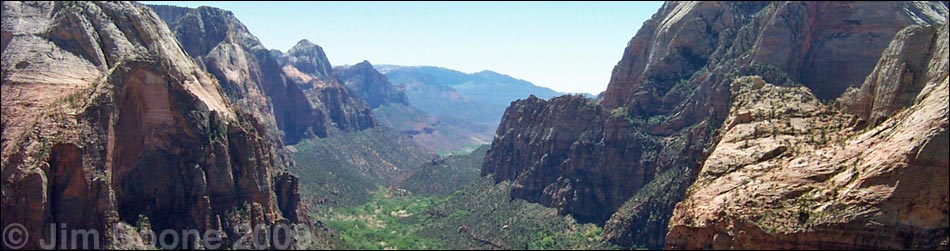
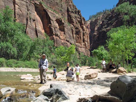
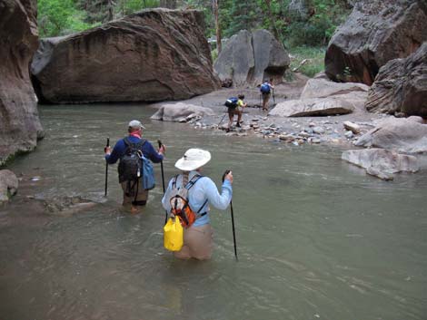
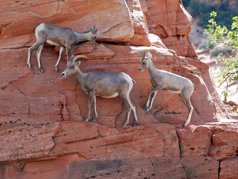
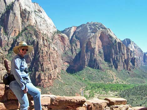
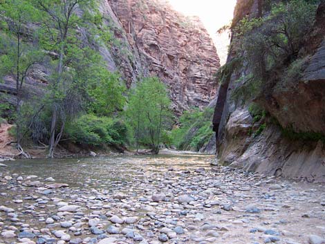
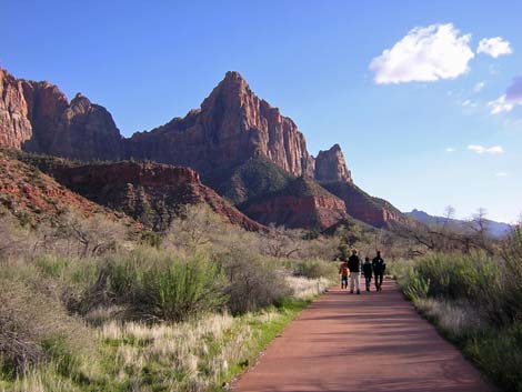
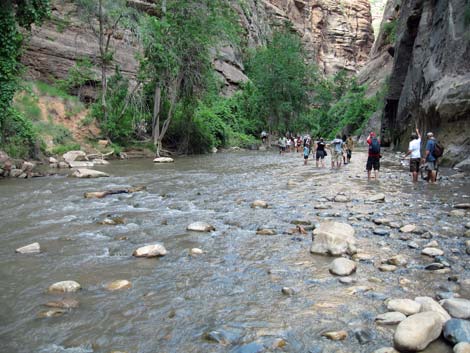
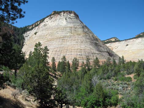
OVERVIEW Zion National Park, administered by the U.S. National Park Service, is located in southwestern Utah, about 3-hours northeast of Las Vegas. The primary feature of the park is Zion Canyon and the sheer sandstone cliffs that tower 2,000 to 3,000 feet above the floor of the canyon. Zion Canyon, however, only makes up a small percentage of the park area, and the other parts of the park are wild lands that offer wonderful hiking opportunities. There are also towering sandstone cliffs and deep valleys in the northwestern portion of the park (the Kolob Region), but not on the same scale as those in Zion Canyon. Higher-elevation forests and sculpted sandstone canyons and mesa tops can be found in the eastern portion of the park. Activities in Zion National Park primarily are orientated around sightseeing and day hiking in Zion Canyon, although there is also picnicking, swimming in the river, horseback riding, biking, backpacking, and car camping. Zion is located at the junction of the Colorado Plateau, the Great Basin, and the Mojave Desert, providing for a mix of habitats and life zones and making for an unusually diverse floral and faunal community. Link to Hikes in Zion National Park. |
 |
Because of the crowded roads and parking areas, the Park Service established a shuttle bus system to eliminate traffic and restore tranquility in upper Zion Canyon. As a result, travel by private vehicles to the upper end of Zion Canyon is prohibited when the shuttle is running (April through October). The park entrance fees cover the shuttle bus, so after you get in the park, the bus is "free." The main highway across the park (Highway 9) is always open to private vehicles (with some restrictions on oversized vehicles), and all other park roads are open. More details are provided below. The bottom of Zion Canyon is relatively low (about 4,000 feet), and temperatures often exceed 100 degrees during summer (but that is cooler than Las Vegas!). It snows during winter, especially in the high country, so hiking in Zion generally is best during the spring and fall (e.g., September to November, and March through May). During July and August, afternoon thunderstorms are common and create two problems: many of the trails are in the bottom of narrow canyons that are subject to flash floods, and many of the other trails are on ridgelines that are subject to lightning. |
 |
Hiking in Zion carries a challenge that Nevada hikers rarely face: hiking permits. Because the area is so popular, backcountry use is highly regulated. Permits are required for overnight travel, climbing bivouacs, longer day trips, and trips requiring descending gear. Permits are issued at the Zion Canyon and Kolob visitor centers. Day-hiking permits are issued the day before the hike, and backpacking permits are issued up to three days before the trip. Permits are not required for the short hikes in Zion Canyon, including short hikes up the Zion Narrows. More details on hiking permits are provided below. For more information on all of these topics, including a variety of maps and images, visit the Zion National Park website. |
 |
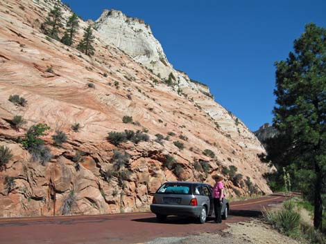
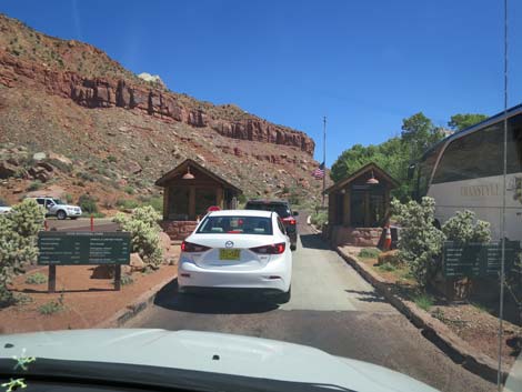
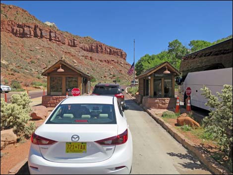
GETTING TO ZION NATIONAL PARK From the perspective of Las Vegas, there are two basic parts of the park: the Kolob Region and the rest of the park (e.g., Zion Canyon, Lava Point area, eastern Zion). To get to the Kolob Region, drive north on Interstate-15 for about 2 hours. About 30 minutes past St. George, signs direct you off the Interstate to the Kolob Visitor Center (Table 1, Site 859). Stop here for information and permits, then continue on the park road to the trailheads and the end of the road (Site 207). To get to the rest of the park from Las Vegas, drive north on Interstate-15 for about 1.5 hours. A few minutes past downtown St. George, turn right onto Utah Highway 9 (Site 860) and drive east towards the town of Hurricane. Drive straight through Hurricane to La Verkin (Site 861). In La Verkin, turn right at the second light (still on Highway 9) and drive east and out of town to Virgin and Springdale. The park entrance (Site 862) is at the far (northern) end of Springdale. Inside the park, drive to the Visitor Center and ride the shuttle (April through October) to the trailheads. |
 |
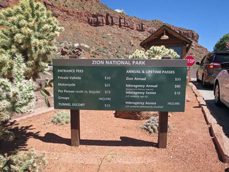
HOURS The Visitor Center is open from 8 AM to 7 PM (note the time-zone difference between Nevada and Utah), 7 days a week during the summer, with shorter hours during the rest of the year. The window for backcountry permits opens at 7 AM during summer and 8 AM during winter. The rest of the park is open 24 hours. There are a variety of concessions (e.g., food, lodging, and horse tours, but no gasoline) inside the park. Most concessions are open during regular business hours or longer. Outside the park, the town of Springdale provides just about everything you would want, and metropolitan St. George provides most of the rest. This is, however, Mormon country, so many stores are closed on Sunday, and alcohol can be hard to find. ENTRANCE FEES The entrance fee is $30 per vehicle or $15 per individual (e.g., pedestrians or cyclists). The entrance pass is valid for 7 days. Golden Eagle and other annual park passes are accepted. The entrance fee pays for the shuttle bus, so after you get in the park, the shuttle bus is "free." |
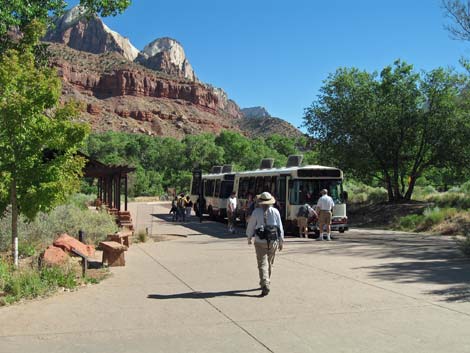 |
SHUTTLE BUS SYSTEM Because of the summer crowds, the Park Service established a shuttle bus system in 1997 to eliminate traffic and parking problems, protect vegetation, and restore tranquility to Zion Canyon. Since then, travel by private vehicles in the upper end of Zion Canyon has been restricted during April through October. The main road across the park (Highway 9) is always open (with restrictions on oversized vehicles in the tunnels), and all other park roads are open, but individuals cannot take private vehicles into upper Zion Canyon when the shuttle system is running (there are exceptions for people staying at the lodge and for handicapped people). Entrance fees (paid as you enter the park) cover the shuttle bus, so after you get in the park, the bus is free. The shuttle bus system is efficient. There are two shuttle routes: one loop outside the park in the town of Springdale (so you can leave your vehicle outside the park and ride the bus to the park entrance), and one loop inside the park that runs from the park entrance (Visitor Center and campgrounds) to the end of the road in Zion Canyon. There are many stops on each loop. During the busy times of the year, buses run about every 6 minutes during the day, but the schedule differs on the two loops and changes during the day and during the year. Round trips on the park loop take about 1.5 hours. |
 |
Getting to the trailheads in Zion Canyon is easy using the shuttle bus, but you can't get there before the buses start running. During summer, the first bus leaves the Visitor Center heading for the end of the road at 5:45 AM, and the last bus leaves the end of the road heading for the Visitor Center at 11 PM. During spring and fall, the first bus leaves the Visitor Center heading for the end of the road at 7:00 AM, and the last bus leaves the end of the road heading for the Visitor Center at 10:00 PM. The buses have room for backpacks, climbing gear, two bicycles, and other equipment, but it is hard to carry lots of gear (e.g., picnic baskets and ice chests of a family picnic) on the bus. The schedule is subject to change, so ask at the park or check the park website. |
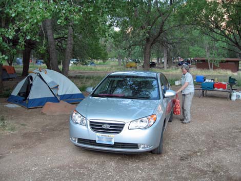 |
CAMPING Car camping is permitted only in the three front-country campgrounds: Watchman, South, and Lava Point. Watchman and South campgrounds are located in Zion Canyon, and Lava Point is located in the north-central part of the park (between Zion Canyon and the Kolob Region). Watchman and South are modern campgrounds with the typical amenities, including running water, flush toilets, and camping fees. Both of these campgrounds are open all year. Lava Point is a primitive campground, does not have running water, is open when there is no snow (about May to October), and is free. Watchman campground accepts reservations), but South and Lava Point campgrounds are first-come, first-served. Backcountry camping is highly regulated, and backpackers can only camp in designated backcountry campsites, on designated nights, and for designated lengths of time. Backcountry permits are required for overnight camping. |
 |
HIKING PERMITS Backcountry use is highly regulated, and backpackers can only camp in designated backcountry campsites, on designated nights, and for designated lengths of time. Permits are required for overnight travel, climbing bivouacs, longer day trips, and trips requiring descending gear. Permits are issued at the Zion Canyon and Kolob Visitor Centers. Permits for day hiking are issued beginning at 7:00 AM the day before your hike. Backpacking permits are issued up to three days before the trip. Permits for hikes through the full length of Zion Narrows are only issued at the Zion Canyon Visitor Center. Permits costs are based on group size, with a maximum group size of 12 people. Cost at $10 for 1-2 people, $15 for 3-7 people, and $20 for 8-12 people. Some reservations can be made online; see the NPS website for permit details. |
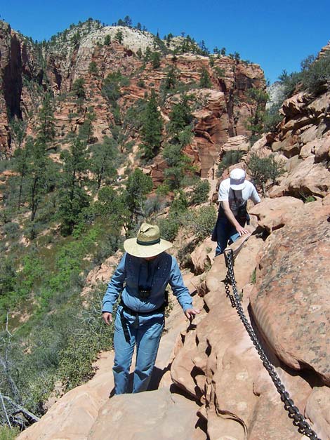 |
WATCH OUT Other than the standard warnings about hiking in the desert, ...many of the hikes lead to precipitous places where footing can be slippery and where falls would result in sudden and certain death. Use caution in these places, stay back from edges, watch your kids carefully, and use the handrails or chains where provided. During July and August, afternoon thunderstorms are common and create two problems: many of the trails are in the bottom of narrow canyons that are subject to flash floods, and most of the other trails are on ridgelines that are subject to lightning. In case of emergency, contact any ranger or call 911. Cell phones work in some parts of park, but don't count on it. There are pay phones in the developed areas (i.e., lodge, campgrounds, and visitor center). SOME RULES AND REGULATIONS This is a National Park. Do not collect or otherwise disturb plants, rocks, fossils, or artifacts, and do not feed or disturb the wildlife. Collecting wood for campfires, including dead and down wood, is prohibited. Pets. Pets are not allowed in public buildings, on buses, in the backcountry, or on trails (except for the Pa'rus Trail). Pets must be on a leash (six-foot maximum) and under your physical control at all times, even in the campground. Never leave a pet in a vehicle because temperatures inside a car parked in the sun can exceed 120 degrees in just a few minutes, quickly cooking your pet. Ditto for kids. Throwing rocks. Don't throw rocks or other objects from high places. There might be people below you. Vehicles and bicycles. Vehicles and bicycles must stay on established roads. For details on these issues and other information, visit the Zion National Park website. Zion maps are also available online. |
 Springdale entrance (view N) |
 Springdale entrance fee sign (view N) [out of date] |
 Springdale entrance -- still waiting (view N) |
 Zion Canyon |
 |
 |
 |
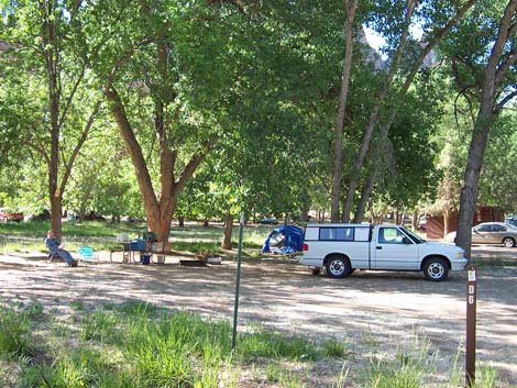 |
Table 1. Highway Coordinates based on GPS data (NAD27; UTM Zone 12S). Note that these are UTM-Zone-12 coordinates.
| Site # | Location | Latitude (°N) | Longitude (°W) | UTM Easting | UTM Northing | Elevation (feet) | Verified |
|---|---|---|---|---|---|---|---|
| 207 | Kolob Region, end of the road | 37.4352 | 113.2005 | 305308 | 4145221 | 6,235 | Yes |
| 859 | Kolob Region Ranger Station | 37.4537 | 113.2239 | 303287 | 4147324 | 5,054 | Yes |
| 860 | Highway I-15 at Highway 9 | 37.1671 | 113.4496 | 282497 | 4116018 | 3,160 | Yes |
| 861 | Highway 9 at La Verkin | 37.2109 | 113.2714 | 298438 | 4120480 | 3,200 | Yes |
| 862 | Highway 9 at Springdale Entrance Station | 37.2012 | 112.9879 | 323575 | 4118838 | 3,940 | Yes |
| 863 | Zion Visitor Center | 37.2000 | 112.9865 | 323702 | 4118706 | 3,940 | Yes |
Happy hiking! All distances, elevations, and other facts are approximate.
![]() ; Last updated 240322
; Last updated 240322
| Birding Around Las Vegas | Hiking Around Las Vegas | Glossary | Copyright, Conditions, Disclaimer | Home |