 |
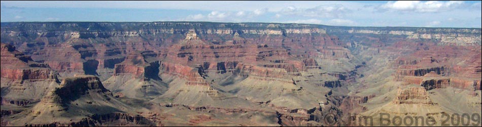
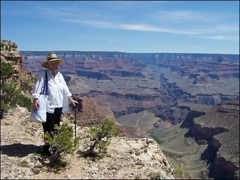
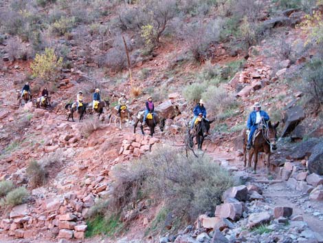
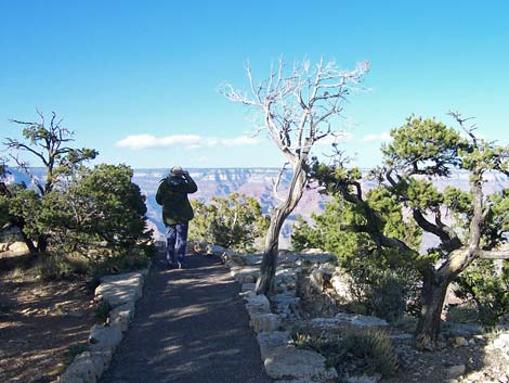
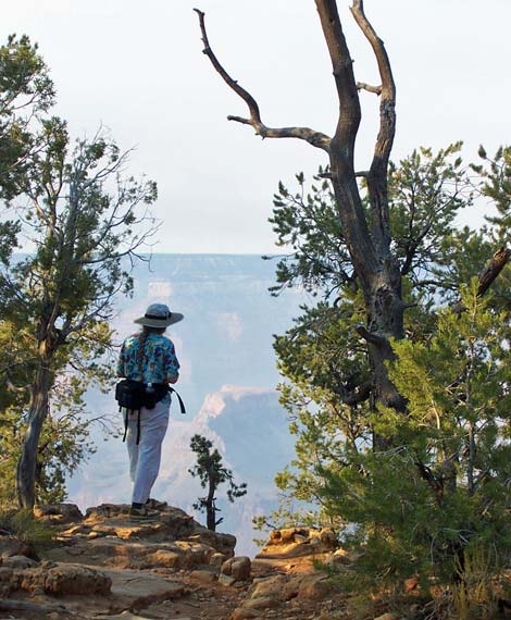
OVERVIEW Grand Canyon National Park, administered by the U.S. National Park Service, is located in north-central Arizona, due east of Las Vegas. The primary feature of the park is the 5,000-foot-deep canyon, cut by the Colorado River, and the scenic vistas across the canyon. There are two sides to every canyon: the South Rim of the Grand Canyon is about 5.5 hours southeast of Las Vegas (via Kingman, Arizona), while the North Rim is about 6.5 hours northeast of Las Vegas (via St. George, Utah). Activities at the Grand Canyon primarily are oriented around sightseeing and day-hiking along the rims, although there is also backpacking into the canyon, picnicking, mule riding, biking, car camping, and lodging. |
 |
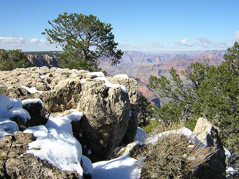
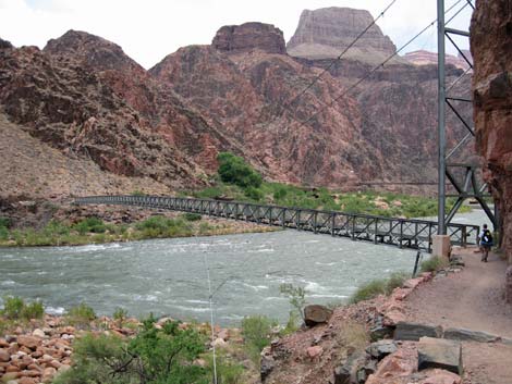
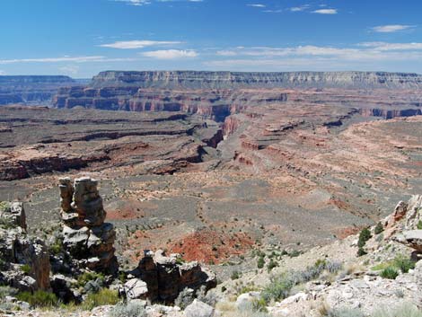
The two rims are located high on the Colorado Plateau. The elevation of the South Rim at Mather Point is 7,120 feet, while the elevation of the North Rim at Bright Angle Point is 8,250 feet. These two points are separated by about 10 air-miles and the Colorado River, which lies some 4,600 and 5,700 feet below the two rims, respectively (2,550 feet elevation at Phantom Ranch). The river is in the low-elevation desert zone, the South Rim is in the mid-elevation pinyon-juniper, yellow-pine forest zone, and the North Rim is in the higher-elevation yellow-pine, fir, spruce forest zone. The great range of elevations makes for a mix of habitats, providing for considerable floral and faunal diversity. |
 |
The South Rim is relatively high (about 7,000 ft), so temperatures are cool compared to Las Vegas, and daytime summer temperatures range in the 50s to 80s, while winter temperatures range in the 20s to 50s. The North Rim is even higher (about 8,000 ft), and summer temperatures there are about 10 degrees cooler than on the South Rim. The North Rim is closed by snow during winter (about mid-October through mid-May). The bottom of the canyon (about 2,500 ft) is hot like Las Vegas, with summer temperatures exceeding 110 degrees. Because of the high temperatures in the inner canyon, hiking generally is best during the fall, winter, and spring (e.g., October to May). During July and August, afternoon thunderstorms are common, creating flash floods and lightning hazards. |
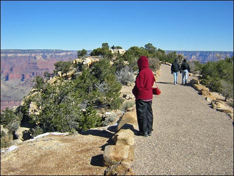 |
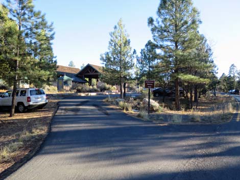
Because of the summer crowds on the South Rim, the Park Service established a shuttle bus system. The park entrance fees cover the shuttle bus, so after you get in the park, the bus is free. The Hermits Rest Road in the western-most portion of the South Rim is closed to private vehicles (with some exceptions) when the shuttle bus is running, but all of the other park roads are open to private vehicles. Buses run throughout the South Rim Village area, so people can park in the village or the campground and ride the bus throughout the area. Details on the shuttle bus system are provided below. |
 |
On the South Rim, there are a variety of concessions inside the park. Grand Canyon Village is a regular city with all of the usual urban services (e.g., grocery store, restaurants, lodging, post office, and bank) except gasoline. Most concessions are open during regular business hours or longer. Outside the park, the town of Tusayan provides gasoline and just about everything else. On the North Rim, services inside the park are limited. This is rural country, so bring what you need. There is a small market, a lodge with a restaurant, a coin laundry, and showers, but no gasoline. Most concessions are open during regular business hours or longer. Outside the park, the town of Jacobs Lake provides limited services (e.g., gasoline, lodge, campground), and a lodge just outside the park provides some basic services and gasoline. |
 |
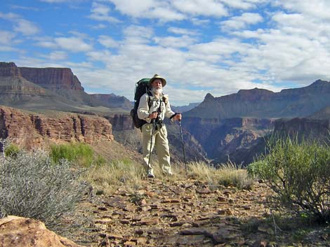
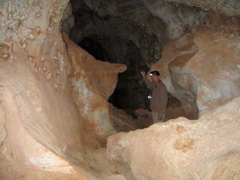
Hiking in the Grand Canyon carries a challenge that Nevada hikers rarely face: hiking permits that can be hard to get. Because the area is so popular, backcountry use is highly regulated. Permits are required for all overnight travel, and most permit reservations are booked solid 4 months ahead of time, but some walk-up permits may be available. Permits are not required for the day-hikes. More information on hiking permits is provided below. If you don't want to hassle permits, or of you fly into the area or otherwise don't arrive with hiking or backpacking gear, consider contacting Four Seasons Guides out of Flagstaff, Arizona. They provide rental gear, guided hikes, and other hiker services. Their prices are reasonable, and the guides are first rate (experienced, knowledgeable, strong as mules, they do everything, and they are good company in camp). For more information on all of these topics, including a variety of maps and images, visit the Grand Canyon National Park website. |
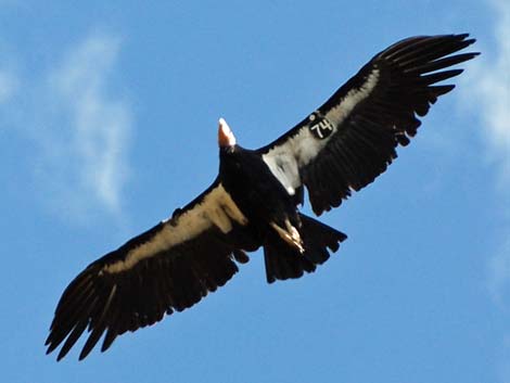 California Condor with tag #74 |
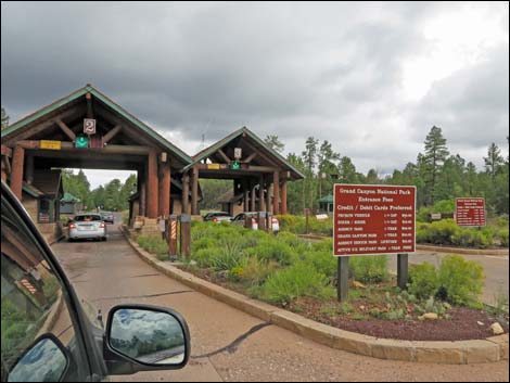
GETTING TO GRAND CANYON NATIONAL PARK Link to map. From the perspective of Las Vegas, there are two parts of the park: the South Rim (280 miles) and the North Rim (260 miles). To get to the South Rim from downtown Las Vegas (Table 1, Site 800), drive south on Highway 93 for about 1 hour to Hoover Dam (Site 812). Cross over the dam into Arizona, and drive for about 1 hour to Kingman (Site 783). In Kingman, turn east (left) onto Interstate-40 and drive east for about 2 hours to Williams. About 2.5 miles past downtown Williams (Site 781), turn north (left) on Highway 64. Every exit sign along Interstate-40 in the Williams area lists the Grand Canyon; don't believe the signs and continue on to Highway 64. Follow Highway 64 north for about 1.5 hours to Tusayan and the park entrance (Site 811). Inside the park, drive to the campground, park, and ride the shuttle to the village and the trailheads. The Canyon View Information Plaza (including the Visitor Center) is the central hub of the transportation system (Site 811). Download GPS Waypoints (*.gpx) file for South Rim roads. |
 |
To get to the North Rim from Las Vegas, drive north on Interstate-15 for about 1.5 hours to Utah Highway 9, which is just past St. George. Exit the highway onto Highway 9 east towards the town of Hurricane. On the far side of Hurricane, turn south (right) onto Highway 59. Follow Highway 59 back into Arizona, where it changes to Highway 389. Continue eastward through Fredonia to Jacobs Lake. In Jacobs Lake, turn south (right) onto Highway 67, the North Rim entrance road. Drive south for 30 miles to the entrance station, and then follow the main road south for another 14 miles to the campground and lodge areas. The North Rim Visitor Center is located at the end of the paved road by the lodge. Download GPS Waypoints (*.gpx) file for North Rim roads, which includes waypoint for Forest Service roads. |
 |
HOURS The park is always open. The South Rim Visitor Center is open 8 AM to 6 PM (Arizona time), 7 days per week during the summer, with shorter hours during the rest of the year. Outdoor exhibits and information can be seen anytime. For backcountry permits, the South Rim Backcountry Information Center (near Maswik Lodge) is open 8 AM to 12 noon, and 1 PM to 5 PM. The rest of the South Rim is open 24 hours. The North Rim Visitor Center and Backcountry Office is open from 8 AM to 6 PM (Arizona time), 7 days a week during the summer. The rest of the North Rim is open 24 hours. |
 |
ENTRANCE FEES The entrance fee is $30 per private vehicle or $10 per individual (e.g., pedestrians or cyclists). The entrance pass is valid for 7 days. Golden Eagle and other annual park passes are accepted. The entrance fee pays for the shuttle bus, so after you get in the park, the shuttle bus is "free." There are other entrance-fee categories, so check the Park Service website or the signs at the park entrance. |
 |
SHUTTLE BUS SYSTEM Because of the crowds on the South Rim, the Park Service established a shuttle bus system to reduce traffic and parking problems. Shuttle buses run all year in the Village area, and from March through November on the Hermits Rest Road. Entrance fees (paid as you enter the park) cover the shuttle bus, so after you get in the park, the bus is free. The Hermits Rest Road in the western-most portion of the South Rim is closed to private vehicles when shuttle buses are running (there are exceptions), but all of the other park roads are open. Buses run throughout the South Rim Village area, so private vehicles are not needed to get around (although you can drive anywhere in the Village Area). |
 |
The shuttle bus system is efficient. There are three shuttle routes: one loop runs throughout the village area (so leave your vehicle parked in the campground or at a lodge), one loop runs west from the village to Hermits Rest, and the third loop runs east from the Canyon View Information Plaza to Yaki Point. There are several stops on each route, and during the busy times of the year, buses run about every 7 minutes during the day, but the schedule differs on the three loops and changes during the day and during the year. Getting to and from the trailheads is easy using the shuttle bus. During the summer, buses start running at 4:15 AM. On the Hermits Rest and Kaibab Trail routes, the shuttles run as late as 9 PM, but they run until 11 PM in the Village. The schedule changes during the year, so check the schedule when you get to the park. The buses have room for backpacks, bicycles, and other personal equipment, but it is hard to get large amounts of gear or large items such as ice chests onto the bus. |
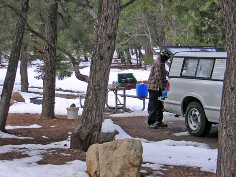 |
CAR CAMPING Car camping is permitted only in campgrounds. There are two campgrounds on the South Rim (Mather and Desert View) and one on the North Rim. Mather Campground is located in the South Rim Village area, while Desert View Campground is located at Desert View (about 45 minutes east of the Village area). All three campgrounds are modern and provide the typical amenities: running water, flush toilets, and camping fees. Showers are available near Mather and North Rim campgrounds. There is also a commercial trailer park on the South Rim in the Village area. Mather campground is open all year. The Desert View and North Rim campgrounds are open when not closed by snow (about May to October). Mather and North Rim campgrounds accept reservations during the summer, but Desert View is always first-come, first-served. |
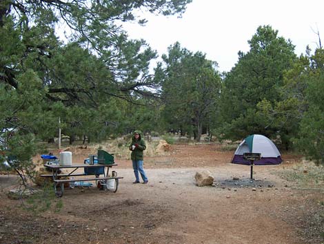 |
Sites in Mather Campground cost $15/night during April through November. Reservations are recommended during these months, but check at the campground for last-minute availability. During December through March, all sites in Mather are available on a first-come first-served basis, and campsites cost $10/night. Sites in Desert View Campground are available on a first-come, first-served basis and cost $10/night. Sites in North Rim Campground can be reserved and cost $15/night. Check at the campgrounds for last-minute availability. Overflow camping is allowed outside the park. On the South Rim, there is a commercial campground in Tusayan. On both rims, U.S. Forest Service campgrounds are available, and dispersed camping is allowed in the national forest. Backcountry camping is highly regulated, and backpackers can only camp in designated backcountry campsites, on designated nights, and for designated lengths of time. Backcountry permits are required for overnight camping. |
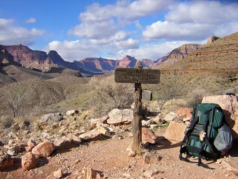 |
BACKPACKING PERMITS Backcountry use is highly regulated, and backpackers can only camp in designated backcountry campsites, on designated nights, and for designated lengths of time. Permits are required for all overnight travel, and the number of permits is limited. The earliest you can make reservations is the first of the month, 4 months in advance of your trip (for example, November 1 is the first day that permits are released for trips starting during March of the following year). Most permits for busy times of the year are taken immediately, but permits may be available on a first-come, first-served, walk-up-only waiting-list basis. Backcountry permit forms can be downloaded, but the form must be FAXed, mailed, or hand delivered to the park (electronic forms should be available in 2023 or 2024). If you succeed in getting a permit, the Park Service will mail it to the group leader, so you don't need to check in before the hike. On the South Rim, same-day permits can be picked up at the Backcountry Information Center (Maswik Transportation Center), which is open 8 AM to 12 noon, and 1 PM to 5 PM during summer. Permits cost $10 each plus $5 per person per night. Permits are not required for day hiking. |
 |
There is a "waiting list" for walk-up permits. If you get to the canyon without a permit, be sure to get a numbered coupon to reserve your place in line as quickly as possible. There is a backpacker campground on the South Rim where backpackers can stay the night before and after their backpacking trip, but only if they arrive without a private vehicle. If you have a private vehicle, you need to make reservations for Mather Campground if you want to stay in the park the night before entering the backcountry. Permit procedure details are posted online. Campfires are not permitted in the backcountry. Water is limited in some parts of the backcountry, so plan to carry large amounts of water if necessary, and filter what you find. |
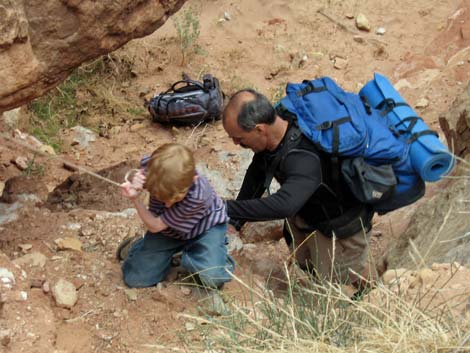 |
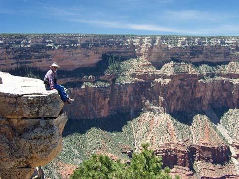
WATCH OUT Other than the standard warnings about hiking in the desert, ...many of the hikes lead to precipitous places where footing can be slippery and where falls would result in sudden and certain death. Use caution in these places, stay back from edges, watch your kids carefully, use handrails when provided, and don't climb over guardrails. During summer months, afternoon thunderstorms are common and create lightning hazards on exposed places along the rim and on ridges in the canyon. Summer temperatures in the bottom of the canyon can exceed 110 degrees, and there is little (if any) shade in the canyon, so hiking mid-day hiking should be avoided. In case of emergency, contact any ranger or call 911. Cell phones work in some parts of park, but don't count on it. There are pay phones in developed areas (i.e., lodges, campgrounds, and ranger stations). Cell phones generally don't work in the inner canyon. |
 |
SOME RULES AND REGULATIONS This is a National Park. Do not collect or otherwise disturb plants, rocks, fossils, or artifacts, and do not feed or disturb the wildlife. Collecting wood for campfires, including dead and down wood, is prohibited. Pets. Pets are not allowed in public buildings, on buses, in the backcountry, or on trails (except the Rim Trail). Pets must be on a leash (six-foot maximum) and under physical control at all times, even in the campgrounds. Never leave a pet in a vehicle because temperatures inside a car parked in the sun can exceed 120 degrees in just a few minutes, quickly cooking your pet. Throwing Rocks. Don't throw rocks or other objects from high places. There might be people below you. Vehicles and Bicycles. Vehicles and bicycles must stay on established roads. Bicycles are not permitted on trails. FOR MORE INFORMATION For details on these issues and other information, visit the Grand Canyon National Park website. Maps are available online. |
 South Entrance Station (view N) |
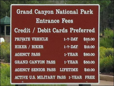 Fee Schedule (September 2014) |
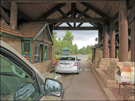 South Entrance Station (view N) |
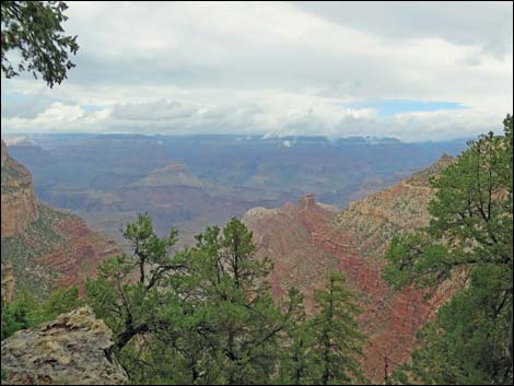 Rainy day at Pipe Spring Overlook (view N) |
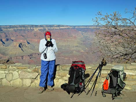 Backpacker with ice cream at Bright Angel Lodge (view N) |
 Exiting the South Entrance (view SE) |
Table 1. South Rim Highway Coordinates based on GPS data (NAD27; UTM Zones 11 and 12). Download GPS Waypoints (*.gpx) file.
| Site # | Location | Latitude (°N) | Longitude (°W) | UTM Zone | UTM Easting | UTM Northing | Elevation (feet) | Verified |
|---|---|---|---|---|---|---|---|---|
| 781 | I-40 at Highway 64, Williams | 35.2605 | 112.1505 | 12 | 395347 | 3902339 | 6,903 | Yes |
| 783 | Highway 93 at I-40, Kingman | 35.1907 | 114.0661 | 11 | 767146 | 3897934 | 3,300 | Yes |
| 800 | Highway 93/95 at I-15 (Spaghetti Bowl) | 36.1743 | 115.1538 | 11 | 666038 | 4004658 | 2,040 | Yes |
| 811 | Visitor Center, Canyon View Information Plaza | 36.0590 | 112.1085 | 12 | 400166 | 3990857 | 7,092 | Yes |
| 812 | Highway 93 at Hoover Dam | 36.0163 | 114.7364 | 11 | 703994 | 3987925 | 1,312 | Yes |
| 813 | Highway 64 at Grand Canyon Entrance Station | 36.0002 | 112.1209 | 12 | 398968 | 3984354 | 6,770 | Yes |
Table 2. North Rim Highway Coordinates based on GPS data (NAD27; UTM Zone 12). Download GPS Waypoints (*.gpx) file.
| Site # | Location | Latitude (N) | Longitude (W) | UTM Easting | UTM Northing | Elevation (ft) | Verified |
|---|---|---|---|---|---|---|---|
| Road 00 | Jacobs Lake | 36.71452 | -112.21535 | 391455 | 4063690 | 7,885 | GPS |
| Road 01 | Hwy ALT89 AT FR422 | 36.93418 | -112.50358 | 366094 | 4088423 | 4,835 | GPS |
| Road 02 | Big Spring RS | 36.60269 | -112.34985 | 379267 | 4051445 | 6,925 | GPS |
| Road 11 | Hwy 67 AT FR22 | 36.40108 | -112.12876 | 398781 | 4028826 | 8,667 | GPS |
| Road 27 | Grand Canyon Lodge | 36.19747 | -112.05222 | 405399 | 4006163 | 8,226 | GPS |
Happy hiking! All distances, elevations, and other facts are approximate.
![]() ; Last updated 240322
; Last updated 240322
| Hiking Around Las Vegas | Glossary | Copyright, Conditions, Disclaimer | Home |